


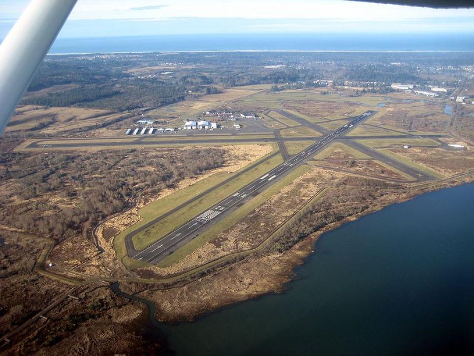
Gallery


Map and nearest places
| Longitude | Latitude |
|---|---|
| 46.157777777777795 | -123.878611111111 |
| 46°9'0"N | 123°52'0"W |
| Nearest places | ||
|---|---|---|
| Warrenton | 3.6km | |
 | Astoria | 5.6km |
| Gearhart | 15.1km | |
| Seaside | 18.7km | |
| Ilwaco | 20.8km | |
| Long Beach | 25.3km | |
| Kelso-Longview Regional Airport | 75.7km | |
| Tillamook Airport | 82.4km | |
| Westport Airport | 83.9km | |
| Scappoose Industrial Airpark | 89.6km | |
| Chehalis-Centralia Airport | 89.7km | |
| Bowerman Airport | 90.5km | |
| John Paul II International Airport | 8,756.8km | |
| Tolagnaro Airport | 17,528.9km | |
General informations
| Airport type | Local airport |
| ICAO | KAST |
| IATA | AST |
| FAA | AST |
| Elevation | 15 ft / 5 m MSL |
| Year | Pax |
|---|---|
| 2004 | 0 |
| 2003 | 0 |
| 2002 | 0 |
| 2001 | 0 |
| 2000 | 0 |
| 1999 | 0 |
| 1998 | 0 |
| 1997 | 0 |
| 1996 | 0 |
| 1995 | 0 |
Weblinks
Comments
You need to log in to add comment