


Map and nearest places
| Longitude | Latitude |
|---|---|
| 61.5263888888889 | -6.876944444444439 |
| 61°31'0"N | 6°52'0"W |
| Nearest places | ||
|---|---|---|
| Tvřroyri | 5.1km | |
| Frođba | 6.1km | |
| Hov | 6.6km | |
| Vagur | 6.8km | |
| Porkeri | 8.6km | |
| Hvalba | 9.2km | |
| Vagar Airport | 63.3km | |
| Westray Airport | 323.9km | |
| Scatsta Airport | 324.5km | |
| Papa Westray Airport | 325.6km | |
| Unst Airport | 334.6km | |
| Tingwall Airport | 339.1km | |
| John Paul II International Airport | 2,072.2km | |
| Stewart Island Airport | 18,357.4km | |
Weblinks
Comments
On 10-25-2022 13:08 Jerzy said:
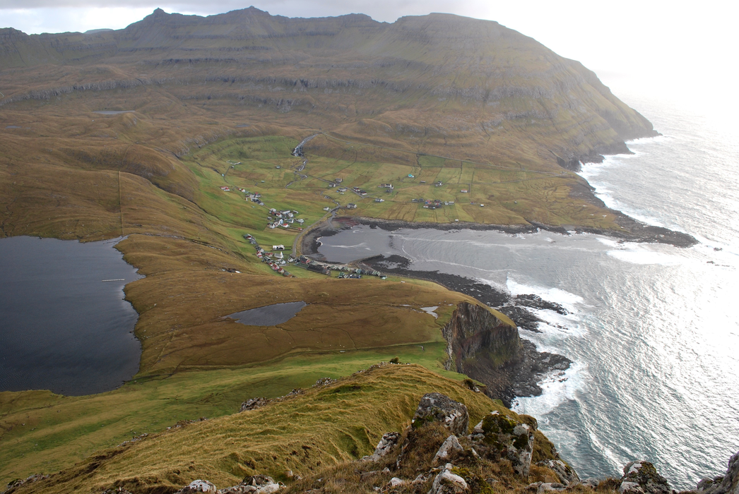
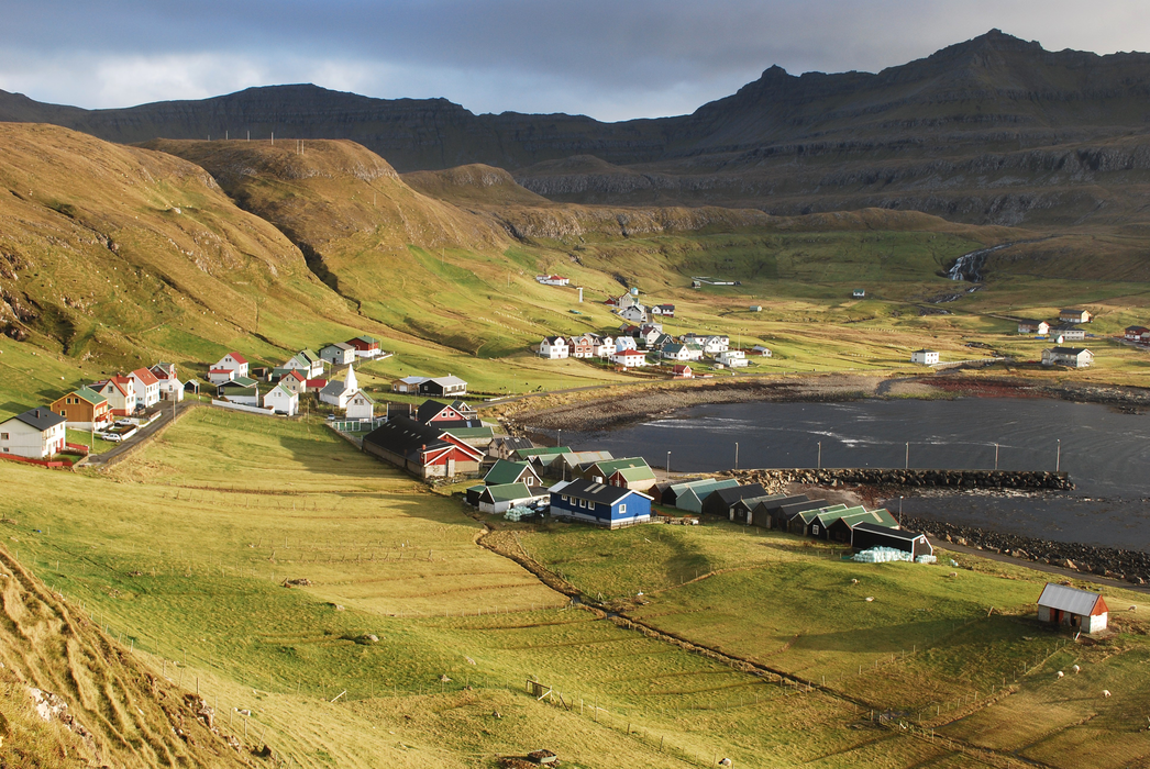
The village Famjin is looking directly out to the harsh North Atlantic Ocean. Famjin is partly protected by a stone reef, which becomes visible at low tide.
You need to log in to add comment
The village Famjin is looking directly out to the harsh North Atlantic Ocean. Famjin is partly protected by a stone reef, which becomes visible at low tide.
You need to log in to add comment